By visiting our site, you agree to our privacy policy regarding cookies, anonymous tracking statistics
May 2024
Aeromagnetic surveying is older than you may think. Magnetic surveying is one of the earliest geophysical methods used, with an early 1600s survey in Sweden used to detect magnetic iron ores. Once instruments were developed in the late 1800s to measure the magnitude of the Earth’s magnetic field, magnetic surveys for mineral exploration became commonplace.
These early magnetometer surveys were limited in areal extent and only small areas could be acquired in detail. In the mid-1900s, with the advent of an aircraft‐mounted magnetometer system developed for submarine detection during World War II, the number and areal coverage of magnetic surveys expanded rapidly.
The first airborne magnetic or aeromagnetic survey for geological purposes was flown in 1945 in Alaska by the U.S. Geological Survey and the U.S. Navy. By the end of the 1940 s, aeromagnetic surveys were commonplace and being flown worldwide.
Aeromagnetic surveys are conducted using an aircraft with an attached magnetometer. As the aircraft flies, the magnetometer measures and records the total intensity of the magnetic field at the sensor. This measurement includes the desired magnetic field generated in the Earth as well as tiny variations due to the constantly varying solar wind and the magnetic field of the survey aircraft.

By subtracting the solar, regional, and aircraft effects, the resulting aeromagnetic map shows the spatial distribution and relative abundance of magnetic minerals (primarily the iron oxide mineral magnetite and pyrrhotite) in the upper levels of the Earth’s crust.
Different rock types have varying content of magnetic minerals, so the magnetic map allows visualisation of the geological structure of the upper crust, especially where bedrock is obscured by surface sediments, soil, or water. Faults and fractures also tend to contain accumulations of magnetite from migrating fluids and hence magnetic surveying can assist in mapping of faults and fractures.
Aeromagnetic surveys are conducted all over the world and some countries such as Australia, Canada and USA invest heavily in systematic airborne magnetic surveys of their respective continents and surrounding oceans. This assists with mapping geology and in the discovery of mineral deposits. Smaller scale surveys are conducted over mineral and oil and gas licenses for more targeted exploration.
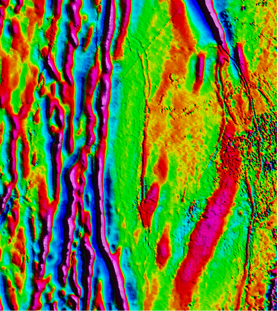
Below is a magnetic grid and is one example of how magnetic data is displayed in map form. In simple terms the strong magnetic highs (red) over magnetic sources and magnetic lows (blue) over areas lacking strong magnetic content. The size and amplitude of the anomalies can infer the depth and extent of the magnetic bodies (for example iron ores).

Aeromagnetic surveys are typically flown on a grid basis along survey lines with further perpendicular (tie) lines. The spacing of the survey- and tie lines is dependent upon the geological targets being surveyed being. Typically, regional surveys may acquire data with a 250-500m line spacing. However, surveys for smaller targets such as kimberlites may demand line spacing of 25m.
Where targets are shallow (<200m), aeromagnetic anomalies may be further investigated with ground magnetic surveys on 10m to 50m line spacing with 1m station spacing to provide the best detail (2 to 10m pixel grid) (or 25 times the resolution prior to drilling).
There are two main categories of airborne magnetometers: scalar and vector.
Scalar magnetometers measure the total strength of the magnetic field, while vector magnetometers measure a component of the magnetic field in a particular direction.
The main types of scalar and vector magnetometers are described below:
Scalar Magnetometers:
Proton Magnetometer: This is based on the precession of hydrogen atoms in a magnetic field. It is very accurate and stable but has a low sampling rate and is sensitive to vibrations.
Overhauser Magnetometer: This is like the proton magnetometer but uses free radicals to enhance the precession signal. It has a higher sampling rate and is less sensitive to vibrations but requires more power and has a lower dynamic range.
Optically Pumped Magnetometer: This is based on the alignment of atoms or molecules in a magnetic field using a laser or a lamp. It can have a high sampling rate and a wide dynamic range but is affected by temperature and pressure changes and is more expensive.
Vector Magnetometers:
Fluxgate Magnetometer: This is based on the induction of a magnetic field in a highly permeable core. It is simple and low-cost but has a limited dynamic range and is sensitive to temperature changes.
Hall Effect Magnetometer: This is based on the deflection of electric current in a magnetic field. It has a high dynamic range and is insensitive to temperature changes but has a low sensitivity and is affected by noise.
SQUID Magnetometer: This is based on the quantum interference of superconducting currents in a magnetic field. It has a very high sensitivity and a wide dynamic range but is very expensive and requires cryogenic cooling.
The choice of the type and technology of the airborne magnetometer depends on the purpose, budget, and environment of the survey. For example, scalar magnetometers are more suitable for mapping the total magnetic field, while vector magnetometers are more suitable for measuring the gradients (horizontal and/or vertical) often for the more detailed surveying requirements for mineral exploration.
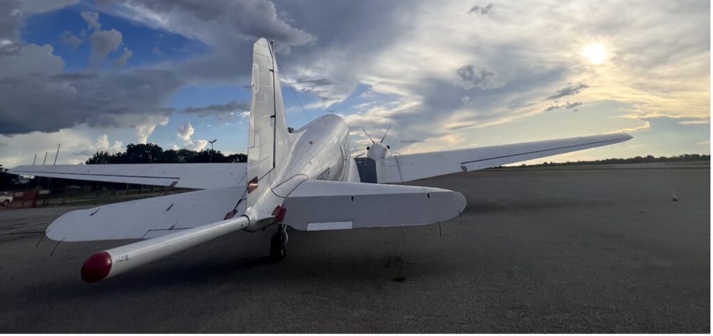
For aeromagnetic surveying, Earthline Consulting uses a scalar magnetometer, specifically a split-beam Caesium Vapour total field magnetic sensor installed in a tail boom. A fluxgate magnetometer coupled with a state of the art, real time compensator is used to remove the magnetic effects of the aircraft in motion. A ground located base magnetometer is also positioned as close to the survey area as possible with a second base station sited within the operational airport or base.
Earthline routinely acquires magnetic data along with Full Tensor gravity gradiometry (FTG) and scalar gravity and all our aircraft benefit from demagnetisation of its airframes and key components.
For more information on Magnetic surveys from Earthline Consulting, take a look at our Technology page. If you have any questions or have an application you would like to discuss, please contact us today.