Earthline logo

Full Tensor Gravity Gradiometry

Full Tensor Gravity Gradiometry is a core service at Earthline Consulting. 

Full Tensor Gravity Gradiometry is a way of measuring changes in the density of the subsurface caused by subsurface geology. It is used by natural resource and mineral prospectors to measure and map changes in the density of the subsurface. 

This information is used to construct a picture of subsurface faults, structures and lineaments, which can then be used to accurately identify a variety of oil, gas, groundwater and mineral targets.

Full Tensor Gravity Gradiometry from Earthline Consulting

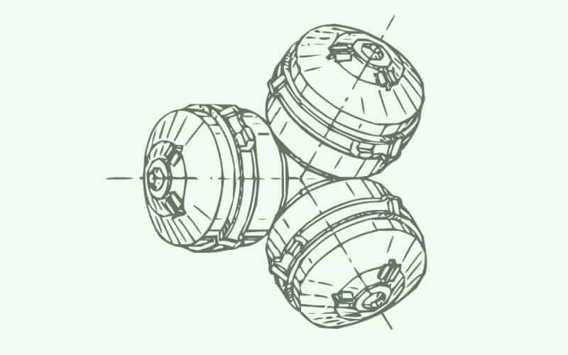
To ensure success when it comes to Full Tensor Gravity Gradiometry, Earthline Consulting has a full suite of gradiometers in our inventory. These include an Enhanced Full Tensor Gradiometer (eFTG), a Digital Full Tensor Gradiometer (dFTG) and an Integrated Full Tensor Gradiometer (iFTG).

Earthline provides the most comprehensive range of Full Tensor gradiometers to suit an extensive range of geological challenges.

Our systems deliver the highest resolving power available today. We have the only Full Tensor Gravity Gradiometry system that can be mounted in a helicopter. All of our systems are supported and maintained by the manufacturer to ensure optimal performance at all times. 

We have a fully comprehensive support and maintenance agreement with Lockheed Martin to ensure parts availability and a service level agreement for routine scheduled maintenance. No other full tensor gravity gradiometry provider can boast this level of performance security to ensure that the acquisition of data happens on schedule.
full-tensor-gravity-gradiometry-technology

Working with Earthline Consulting on your Full Tensor Gravity Gradiometry Project

Feasibility studies are prepared for each and every project with bespoke survey designs, full budgetary proposals and measurable performance indicators. Earthline Consulting provides an unbiased recommendation on the best technical solution available using only current, up-to-date instruments.

Key Features of Earthline Consulting Gradiometry Instruments:

  • All of our gravity gradiometer systems are full tensor, acquiring all nine components of gravity. There is no partial tensor and no computation of noise to fabricate missing components.
  • eFTG, dFTG and iFTG each have specialist acquisition benefits; Earthline Consulting can allocate the correct instrument to best suit your objectives.
  • All three instruments have full support and maintenance from the manufacturer Lockheed Martin, guaranteeing parts availability.
  • All three instruments have the latest software and hardware as per manufacturers’ specifications to ensure optimal data quality.
  • When Earthline Consulting acquires eFTG, dFTG and iFTG data,magnetics and LiDAR are also acquired as part of the standard deliverables.
  • Minimal environmental footprint.


Specific Technical Advantages of Earthline Consulting’s Gradiometry Instruments:

  • Increased signal recovery: The 12 accelerometers in the FTG (24 in the eFTG) are arranged to mitigate platform motion so that high signal-to-noise ratios are achievable in high acceleration environments such as atmospheric turbulence.
  • Short wavelength information: Minimal filtering means wide bandwidth data that retains the finest details of the geological signal, allowing the definition of small mineral targets as well as large-scale regional features.
  • Offline imaging: Full tensor measurements help place an anomaly in its correct position when perturbing geology is present out of the plane of imaging.
  • Joint processing of AGMA and eFTG gradiometry data: In the same way that the iFTG incorporates a conventional gravimeter (the GMA), Earthline Consulting’s eFTG system includes the Advanced Gravity Module Assembly (AGMA). The combined processing produces the high-definition gravity field, gzHD.
  • Integrated design: The AGMA is mounted on the eFTG’s stabilised platform allowing both instruments to be co-located at the ideal position inside the aircraft.
  • Improved data: Integrating the gradiometric data with the direct measurements of the gravity field help define the long wavelength trends in the data. This is essential for developing the correct geological interpretation and the building of accurate geological models.
  • Definition of anomalies: Flying low-altitude draped surveys helps to maximise signal amplitude for small and subtle prospects such as mining and shale targets.
Full Tensor Gravity Gradiometry

Full Tensor Gravity Gradiometry Projects

For Successful Full Tensor Gravity Gradiometry Projects, Earthline Consulting works closely with our clients to:

  • Establish the rock properties, in particular, the relationship between velocity and density
  • Use depth estimation techniques to produce depth to sources over key anomalies
  • Create 2D cross-section geological models that satisfy the seismic interpretation and potential field data
  • Incorporate all the above into a 3D model to obtain constrained depth surfaces


Whatever your exploration challenges, we can help find a solution.

Get In Touch

Call us on +44 1908 667014, or use the form below and we’ll get in touch as soon as possible.