By visiting our site, you agree to our privacy policy regarding cookies, anonymous tracking statistics
September 2024
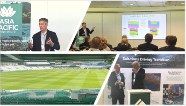
Southeast Asia was in focus at the Oval, London where Earthline Consulting presented a key talk on airborne surveying for Geothermal Energy.
Jon Watson, Earthline Consulting’s GM and interpretation manager showed some results from one of our recent airborne surveying for geothermal energy in Japan. This illustrates the power of eFTG surveying in understanding the subsurface ‘plumbing’ of geothermal systems.
The talk was part of the keynote session on ‘Asia Pacific in Energy Transition’ and focused on an airborne survey undertaken for JOGMEC at the end of last year. The acquisition was undertaken rapidly at a time when the flying weather was deteriorating as the winter season began. When conducting airborne surveying for geothermal energy, the weather is always a factor which could get in the way. The survey was flown over mountainous terrain with considerable turbulence although visibility was sufficient to allow for safe flying operations. The eFTG instrument, due to its advanced design, was able to deliver excellent geothermal energy data within specification, despite these challenging conditions.
The Lockheed Martin eFTG system constitutes a significant advance in gradiometry technology and was introduced in 2020. It comprises the best design elements of both partial and full tensor gradiometers, essentially comprising three digital tensor discs/GGIs mounted in an FTG configuration.
This means the eFTG GGIs have eight accelerometers per disc with a measurement baseline roughly double that of earlier FTG accelerometer separation. This increase in accelerometers and larger baseline means the eFTG has a threefold improvement in signal to noise over the entire bandwidth, allowing excellent data to be acquired in conditions when other systems would fall out of specification and aircraft would have to return to base.
Also, with 24 accelerometers the eFTG provides 12 gravity gradient outputs per measurement location (the eFTG essentially measures the full tensor twice and with double the accuracy in each case), alongside measuring the scalar gravity through the eFTG Advanced Gravity Module Assembly (AGMA).
In late 2023 Earthline Consulting completed the acquisition, processing and interpretation of an airborne geophysical survey over an area of 1047km2, for the purposes of further advancing geothermal energy exploration. The area of interest contains a number of hot-spring resorts and geothermal stations and further development is planned to maximise the geothermal potential of the area.
Objectives of the geothermal survey were to confirm the location, extent and depth of areas surrounding the volcanic magma chambers, model those volcanic centres and identify the faults and lineament through which the heat source may propagate to surface.
The geophysical tools used were enhanced Full Tensor Gravity Gradiometry (eFTG), eFTG Scalar Gravity unit (the AGMA), magnetics and LiDAR. The survey was acquired over an area of both rural and urban centres (spa and ski resorts), with topography ranging from 91m to 2037m. Due to the need to achieve low flight heights, to maximise data resolution, a careful multi-azimuth aircraft flight drape was considered.
Acquisition commenced late Autumn 2023 . Acquisition was over 14 short production flights.
Processing was completed within 4 weeks, followed by a 6-week interpretation of all the datasets, to produce both qualitative and quantitative interpretation deliverables, including 2D and 3D modelling.
The eFTG data provided a wealth of information on the density distribution of the subsurface, the location and depth propagation of the major and minor faults and lineaments. In particular, the location of low-density depocentres surrounding the volcanic centres were of interest. The magnetic data provided detailed information on the distribution and character of the volcanic features, and confirmed faulting and lineaments, due to the mineralisation of the fluid pathways.
The fully processed point-cloud LiDAR datasets provided a bare-earth model of the topographic surface, in a highly forested area, allowing surface geology features to be identified; calibrated against legacy geology maps and used alongside the eFTG and magnetic data to propagate from the surface to deep.
If you have any questions or want more information on Jon’s talk regarding airborne surveying for geothermal energy, then contact us today.
